|
|
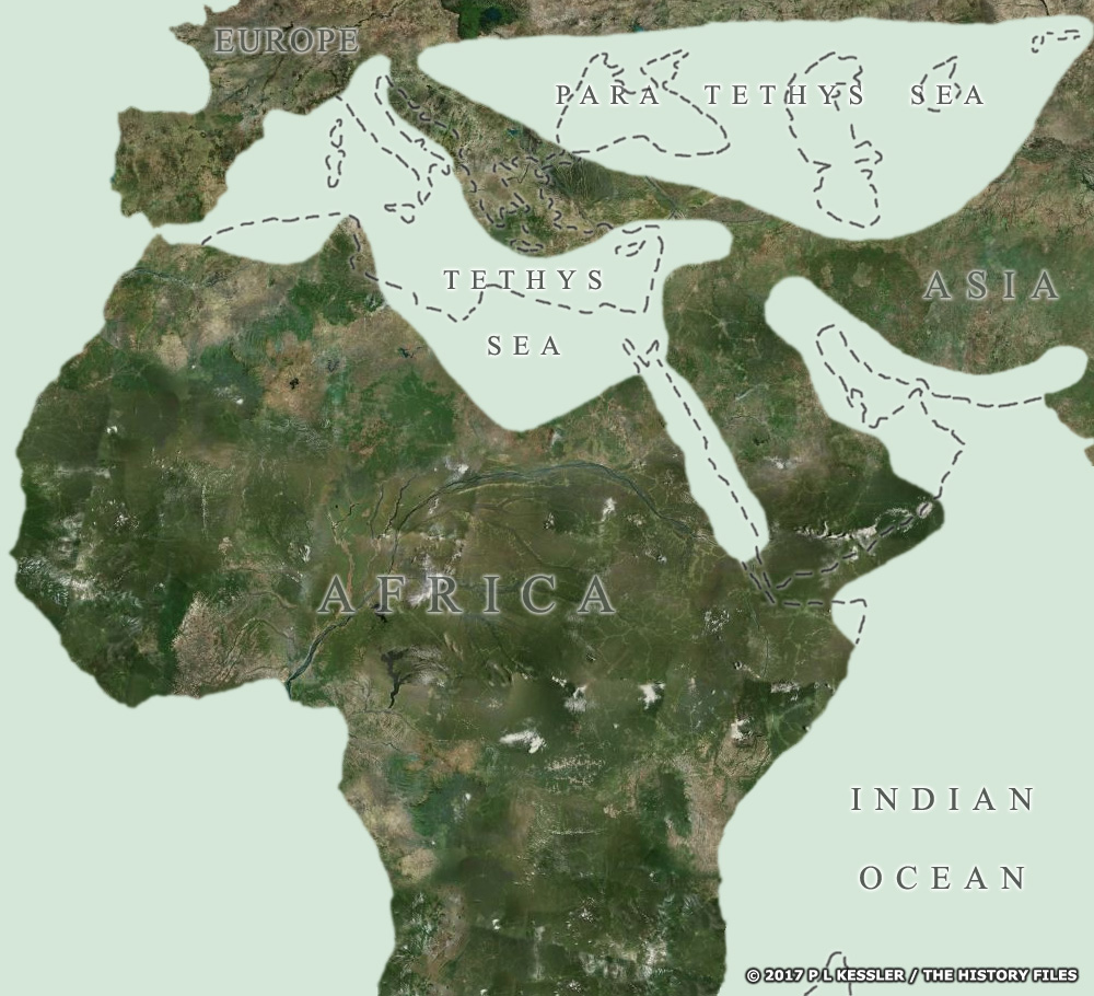 |
Middle Miocene coast (16-10 million years ago) |
|
This map shows the Tethys Sea 16 million years ago, of which only the Mediterranean survives today (the dotted lines show the modern coastlines, with the Para Tethys Sea surviving as the Black Sea, Caspian Sea, and Sea of Azov). It is the Middle Miocene era, some two million years after a series of movements in the Earth's crust had connected Africa and Eurasia for the first time. This land bridge allowed African animals, including apes and monkeys, to cross into Europe and Asia, while some rodents and cats moved in the opposite direction. The collision between continental plates caused major geological upheavals, transforming formerly flat landscapes by pushing up the world's youngest mountain chains: the Pyrenees, the Alps, the Himalayas, and the Zagros Mountains. East Africa's mountains and rift valleys were also created as the continent began to be torn apart at the point of the rift, which is still deepening and widening with time (eventually, this will lead to ocean waters rushing in to form a new gulf as Somalia breaks away from Africa). Geographical transformations were accompanied by gradual climatic and environmental changes. In East Africa, drier conditions during the Middle and Late Miocene caused a spread of grassland. Animals adapted in response to these changes, which may even have triggered the emergence of the first hominoids.
Map navigation: |
|
Image © P L Kessler and the History Files. Text drawn from the Times Atlas of Archaeology (1989). An original feature for the History Files. Go back or return home. |