|
|
|
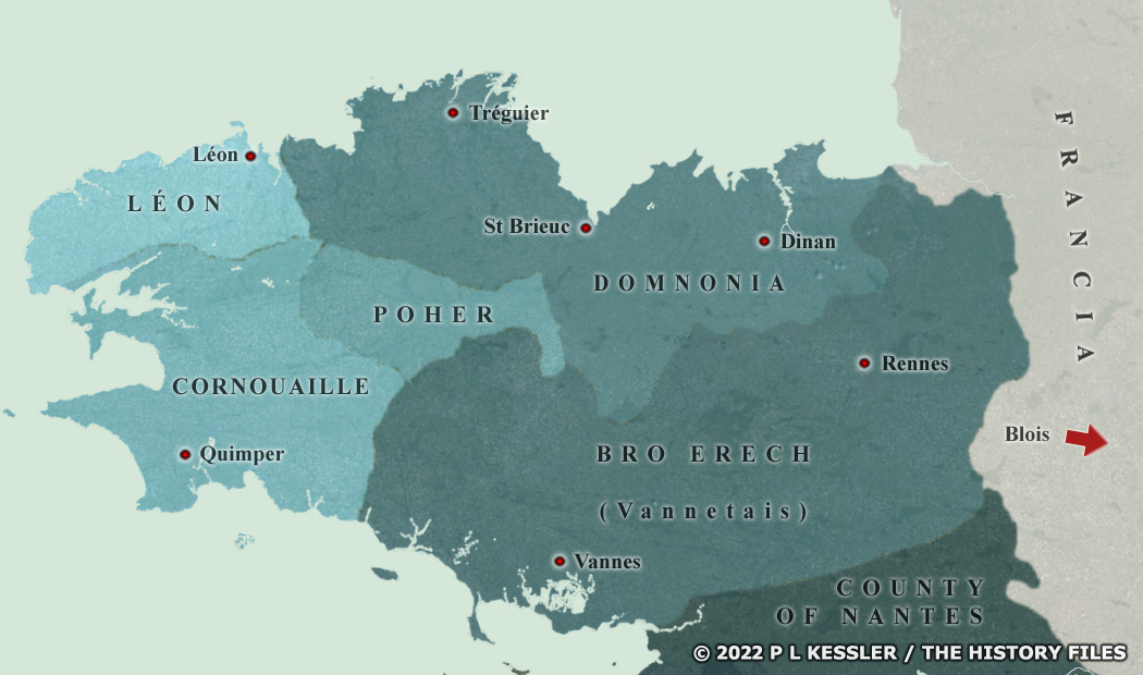
Map of British Armorica |
|
The kingdom of Vannetais was largely formed out of territory which today is part of Brittany, plus eastward extensions which fluctuated over time. Vannetais was created during the late fourth century. It enjoyed a peak of expansion and power up until 491. This 'Little Britain' covered Gaul to the north of the Loire, up to Blois. But, once the Franks had conquered that latter town, something far closer to the traditional borders of Brittany were very quickly established and remained much the same until Breton independence was finally lost, by marriage into the French crown and under the terms of the Treaty of Vannes in 1532. Conan Meriadog oversaw the beginings of British settlement in the region, with various groups from Britain founding their own minor principalities or sub-kingdoms, all of which seem to have acknowledged the overall supremecy of the kings of the Bretons. The name Vannetais seemingly continued to be used in the kingdom's eastern territories until they were renamed Bro Erech in the sixth century in honour of Waroch. The map used here depicts the established borders of the kingdom of Brittany but shows, where possible, lands which were part of the greater Breton holdings at various times. (NB: The positioning of Poher on this map is roughly calculated from the little available evidence, and may not be entirely correct.) A clickable version of this map is available for desktop displays. To select a territory for further information, click anywhere within its borders.
Map navigation: |
|
Original text and map copyright © P L Kessler and the History Files. An original feature for the History Files. Go back or return home. |