|
|
|
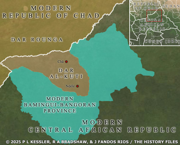
Map of Dar al-Kuti AD 1800s |
|
The sultanate of Dar al-Kuti was located in the north of today's Central African Republic (CAR), forming a small pocket of territory within one of the many modern CAR provinces. Several other equally small sultanates also existed in the region, including those of Bangassou, Rafaï, and Zémio. All three of those were relatively quickly gobbled up by the expanding French Congo territory, but Dar al-Kuti hung on a little longer, largely self-governed until 1911. A clickable version of this map is available for desktop displays. To select a kingdom, state, or tribe for further information, click on its name.
Map navigation: |
|
Original text and map copyright © Richard A Bradshaw, Juan Fandos-Rius, P L Kessler, and the History Files. An original feature for the History Files. Go back or return home. |