|
|


|
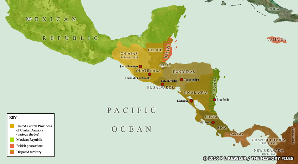
Map of Central America in the 1830s |
|
The Federal Republic of Central America was formed of Chiapas, Costa Rica, El Salvador, Guatemala, Honduras, and Nicaragua. This lasted from 1823-1841, by which time Mexico had grabbed much of Chiapas and the republic itself dissolved into the separate nation states known today - although Nicaragua did not control the independent Mosquito Coast until the end of the century, and British troops occupied eastern Belize. A clickable version of this map is available for desktop displays. To select a kingdom, state, or tribe for further information, click on its name.
Map navigation: |
|
Original text and map copyright © P L Kessler and the History Files. An original feature for the History Files. Go back or return home. |