|
|
|
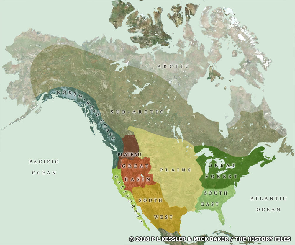
Map of North American Native Regions |
|
This clickable overview map of North America shows the regions used by modern scholars to group the native tribes prior to the arrival of the European colonists. The regions have been constructed by looking at geographic differences. Since environment determines many ways of life, tribes within each division tended to share a significant number of cultural traits. The different geographic regions therefore define and delineate cultural areas. There are ten regions (or cultural areas) for North America. It was the natives of the Great Forest and South-East regions who were first encountered by the French, English, and Spanish, with some lesser degree of contact with Sub-Arctic tribes. Little serious contact was made with the Plains natives until after the formation of the USA. A clickable version of this map is available for desktop displays. To select a region, click within its borders.
Map navigation: |
|
Original text and maps copyright © P L Kessler, Mick Baker (see Bio), and the History Files. An original feature for the History Files. Go back or return home. |