|
|
|
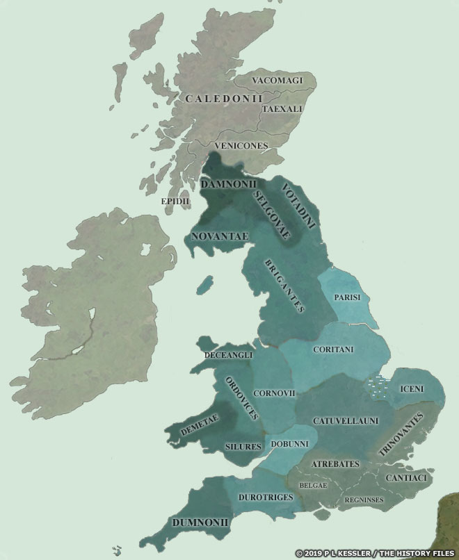
Sequential Maps of Pre-Roman Britain 55 BC-AD 4354 BC When Julius Caesar landed on the Kent coast in 55 BC, he had a basic knowledge of what to expect of the south-eastern Britons from his dealings with their close relatives on the Continent. What he wasn't prepared for was the English Channel, and some bad weather almost cost him dear. His expedition doesn't seem to have made it out of Kent's borders on this occasion. However, when he returned a year later, it was with a much larger force and a much better idea of how to deal with some of the problems. He quickly defeated the Cantiaci tribe and advanced towards the Thames, crossing it at modern-day Brentford in Essex. He received envoys and offers of friendship from six tribes in the south, although the British tribal names which are mentioned (not shown) cannot be tied in with any later information. Then he marched on the Catuvellauni stronghold near St Albans, and his victory over them would have delivered him the entire south-east had he stayed. Instead, he decided to winter in Gaul, and events there conspired to prevent him ever returning to Britain. |
|
Map navigation: |
|
Original text and maps copyright © P L Kessler and the History Files. An original feature for the History Files. Go back or return home. |