|
|
|
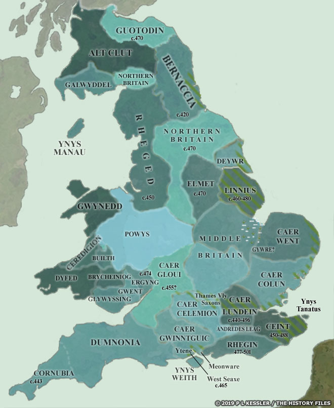
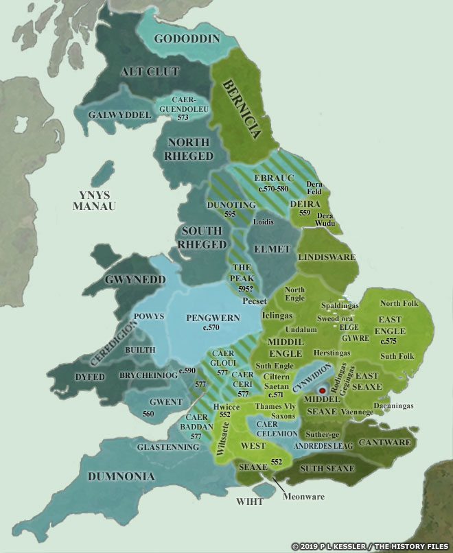
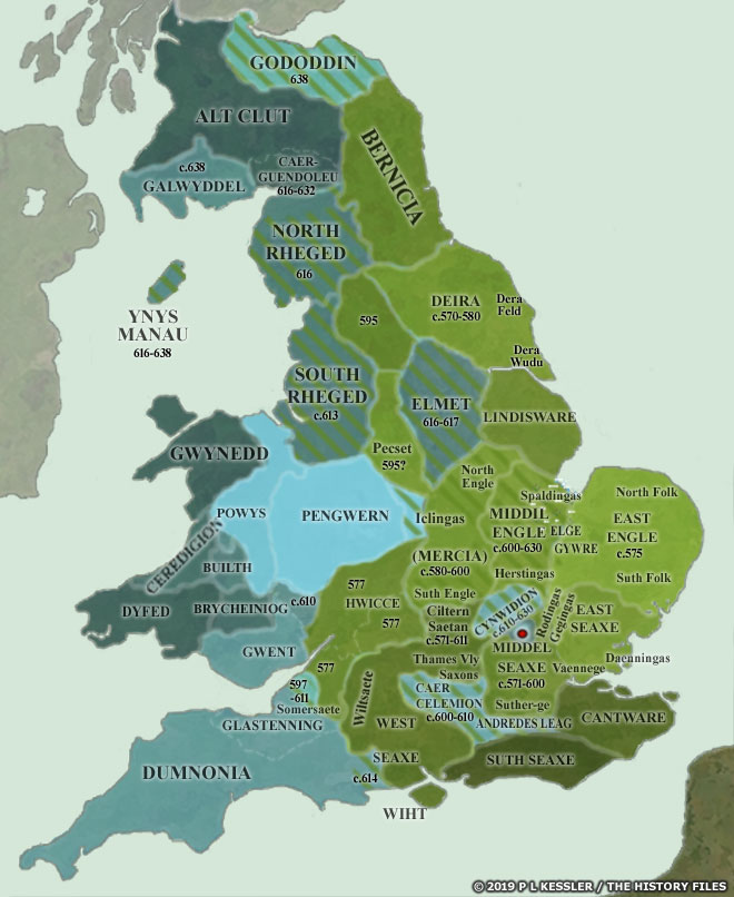
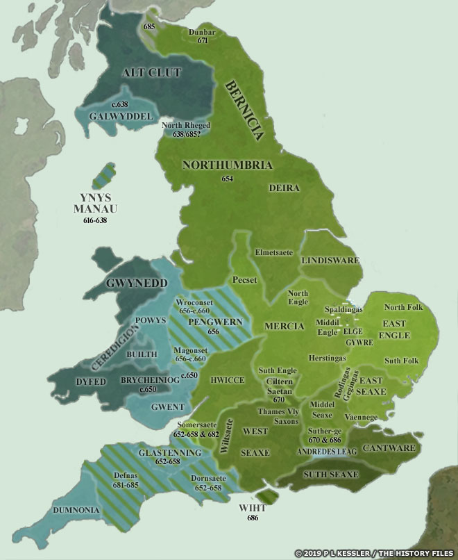
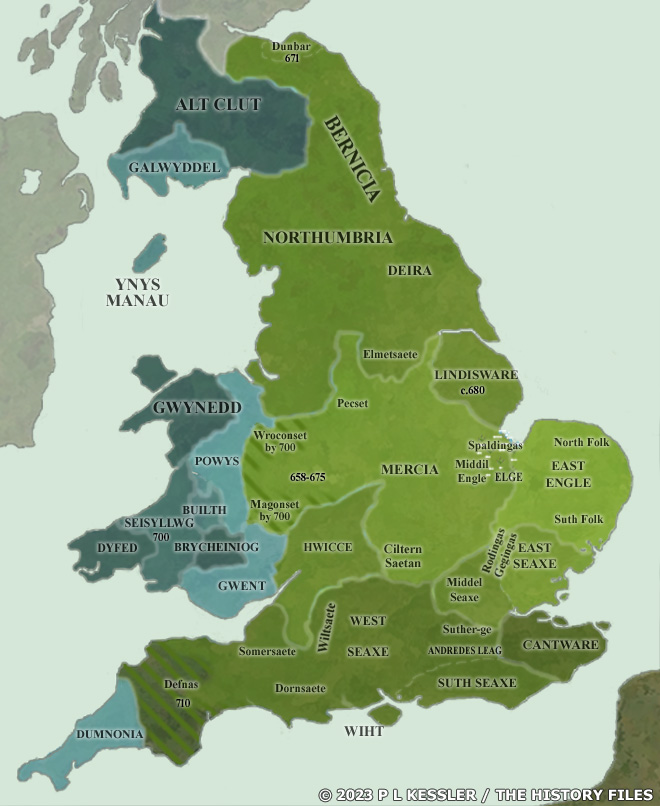
Sequential Maps of the Anglo-Saxon Conquest AD 450-700AD 450-475 The Roman administration of Britannia officially came to an end in AD 410, although in practise the Romano-British had governed themselves for some time and had expelled that administration in 409 anyway. The reorganisations of Magnus Maximus, in the 380s, which had secured Britannia's western and northern borders, had begun to break down. Northern Britain was fragmenting as it was gradually divided piecemeal between surviving descendants. Its final division seems to have come circa 470 with Ebrauc losing its western arm, the Pennines. Likewise, Powys was divided in two following the civil war between Vortigern and Ambrosius Aurelianus. The region which has sometimes been labelled 'Middle Britain' in the more highly civilised heartland of sub-Roman Britain was apparently also in the process of a slower break-up. Along the Saxon Shore, former laeti settlements and waves of new arrivals were asserting their independence. Hengist and Horsa led the swift conquest of eastern Ceint, while Saxon groups pushed deep into the Thames Valley, and Angles invaded Caer Went and Linnuis. Only Bernaccia and Deywr seemed to be blessed with peaceful Angles on their coastlines. |
|
Map navigation: |
|
Original text and maps copyright © P L Kessler and the History Files. An original feature for the History Files. Go back or return home. |
