|
|
|
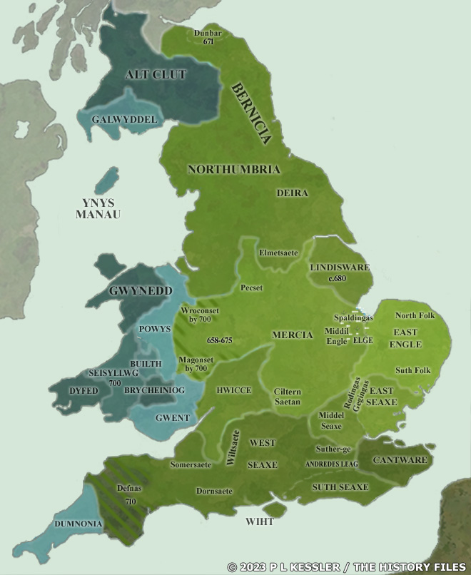
Map of the Anglo-Saxon Kingdoms AD 700 |
|
By AD 700, the Angles and Saxons had conquered and settled much of what was becoming England (Engle-land). The former Britons, their post-Roman civilisation having collapsed to a very large extent, had transformed in just two centuries into the Early Welsh, their language changing considerably to reflect their increasing isolation, even from British kingdoms outside of western Britain. From this point onwards, they were never in the ascendant, merely surviving for the most point as their eastern borders were gradually compressed. By AD 700, Northumbria had been the dominant kingdom for half a century, but the tide was starting to turn in Mercia's favour. It had increased its territory by over a third with the absorption of Pengwern, and was ready to dominate eighth century England. Every kingdom south of the Humber would pay tribute to it at some point during the century. The Welsh territories were only just beginning to build towards a single united state, a process which began with the enlargement of Ceredigion to include Ystrad Towy to its immediate south. A clickable version of this map is available for desktop displays. To select a territory for further information, click anywhere within its borders.
Map navigation: |
|
Original text and map copyright © P L Kessler and the History Files. An original feature for the History Files. Go back or return home. |