|
|


|
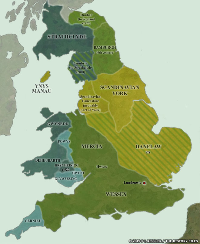
Map of England and Wales AD 900-950 |
|
By the dawn of the tenth century the period of invasion and conquest by the Vikings, mostly originating from Denmark or Viking Dublin, had ended. The Viking conquest of the kingdom of Northumbria had resulted in the fragmentation of this territory north of the Humber. By 875 the invaders had grabbed former Deira, Elmet, and Dunoting, plus areas of what had been South Rheged. Former Bernicia regained its independence by the early tenth century as an English sub-kingdom, while Cumbria (which had been part of Northumbria since the fall of North Rheged) fell into the hands of Strathclyde around the turn of the century. While the history of Lancashire at this point is extremely unclear, the Danelaw was retaken by Wessex in 918, which had also controlled Mercia since 879, but the Vikings managed to hold onto Ynys Manau (the Isle of Man) until 1265. Wales was taking great steps towards the consolidation of its many principalities. All of them, along with Dumnonia and the Scots and Picts, were tributary to the English kings at this time. The Scandinavian kingdom of York itself finally fell to the English in 954, creating a fully unified English kingdom. Although not strictly relevant here, the Scottish crown captured Dunbar circa 975, bringing the island one step closer to its modern borders A clickable version of this map is available for desktop displays. To select a territory for further information, click anywhere within its borders.
Map navigation: |
|
Original text and map copyright © P L Kessler and the History Files. An original feature for the History Files. Go back or return home. |