|
|
|
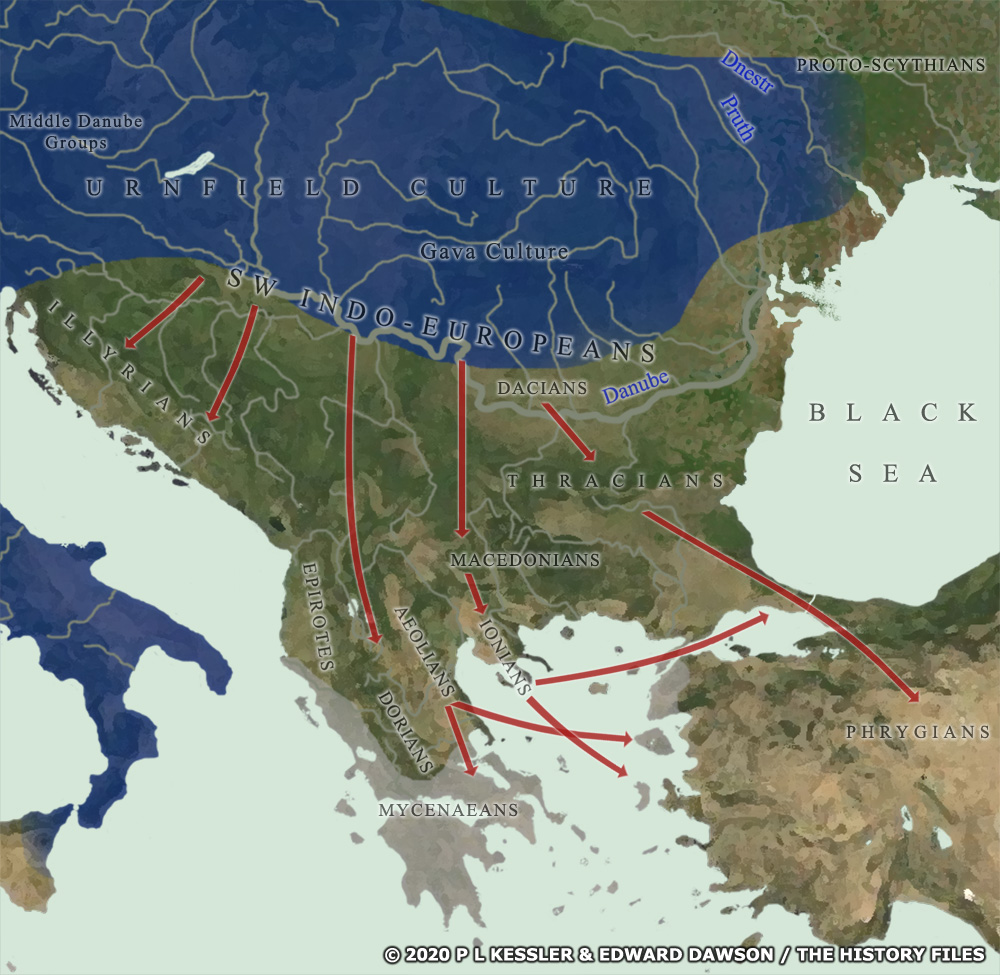
Map of Eastern Europe, the Balkans, & Greece 1200 BC |
|
Around the end of the thirteenth century BC the entire eastern Mediterranean region was hit by drought and the loss of surviving crops. Food supplies dwindled and the number of raids by various patchwork groups increased exponentially. By about 1200 BC, this flood had turned into a tidal wave of destruction, abandonment, and migration. In the case of the South-West Indo-Europeans, that migration meant following what was probably already an active route for low-level movement and also some trade, taking them southwards towards Mycenaean Greece. They divided along the way (if such divisions did not already exist), with the Illyrians heading for the west coast, the Epirotes doing the same on the edges of Mycenaean occupation, the Thracians and Phrygians heading towards the eastern coast, the Macedonians slotting in between the two coasts, and the Dorians, Ionians, and Aeolians heading into Mycenae and the islands of the Aegean. The Ionians even ventured through the Bosphorus to begin proto-Greek settlement in the Black Sea region. The Dacians seemingly moved the least - if at all - probably being able to make the most of their increased resources and lower population levels along the Danubian shoreline. A clickable version of this map is available for desktop displays. To select a kingdom, state, or tribe for further information, click on its name or within its borders.
Map navigation: |
|
Original text and maps copyright © P L Kessler, Edward Dawson, and the History Files. An original feature for the History Files. Go back or return home. |