|
|


|
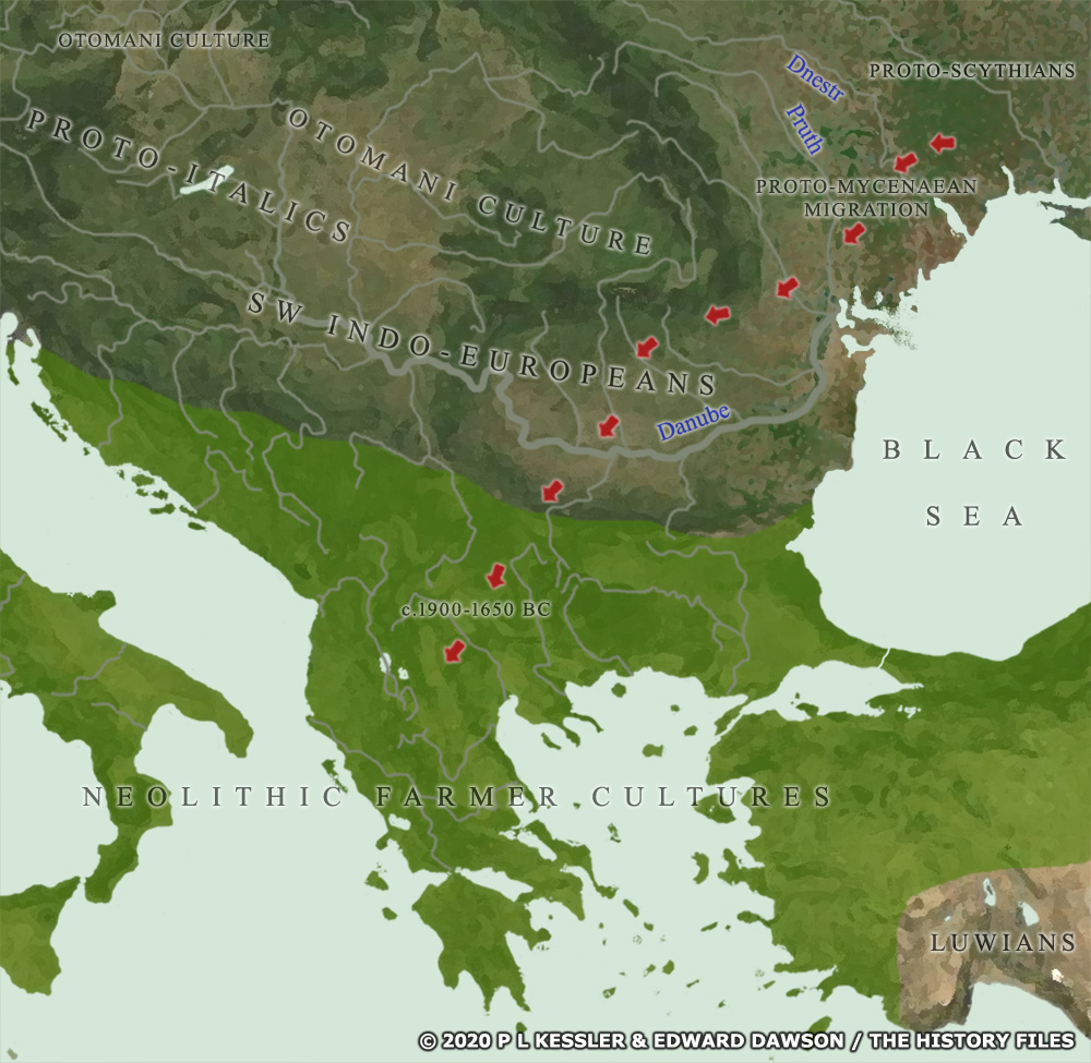
Map of Eastern Europe, the Balkans, & Greece 1900-1650 BC |
|
By the tail end of the Yamnaya Horizon if not before - around 2000 BC - the eastern, satem-speaking Indo-Europeans who would eventually form into the Scythians of the first millennium BC were likely to be 'encouraging' the western centum-speaking Indo-Europeans to leave the Pontic steppe. The stream of western Indo-European migration had begun at least a millennium before this. They entered into the Danubian river basin after crossing the River Prut (Pruth), congregating along the river's course as far west as Budapest. Elements of what can be termed the South-Western Indo-European group began fanning outwards into Romania, Bulgaria, Croatia, and so on. There they eventually diverged into separate groups which would become Illyrians (who also bore Italic influences, suggesting no firm dividing line between these two main units of Indo-Europeans), Epirotes, Dorians, Aeolians, Ionians, Macedonians, Thracians, Dacians, Phrygians, and probably Armenians too. Before that happened though, the proto-Mycenaeans seem to have been amongst the last of the centum-speakers to take to the road, possibly against their will so late was their migration. They proceeded down through the Balkans to enter Greece and create a civilisation which would dominate the Aegean for over half a millennium. Tribes or groups which were further along the Danube, closer to Budapest, appear to have divided into at least three sub-groups themselves: one which moved into Transylvania, sheltered by the Carpathian Mountains (Otomani cultural territory in the upper centre of the map); the main group in Hungary which gradually filtered further west, becoming the proto-Italics and various smaller groups; and the third group which branched off towards Bavaria and Switzerland to become the proto-Celts. A clickable version of this map is available for desktop displays. To select a kingdom, state, or tribe for further information, click on its name or within its borders.
Map navigation: |
|
Original text and maps copyright © P L Kessler, Edward Dawson, and the History Files. An original feature for the History Files. Go back or return home. |