|
|
|
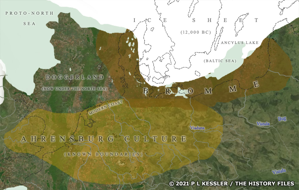
Map of Northern Europe 12,000 BC |
|
Shown here are the approximate coastlines of Northern Europe around 12,000 BC, about four hundred or so years before the appearance of the Bromme culture, although changes between the two dates would not have been vast. The black dashed lines mark out present-day coastlines. The ice sheet is busy retreating at this stage, but Scandinavia is still covered, and the Ancylus lake (which forms the origins of today's Baltic Sea) is only just being formed from meltwater. The Ahrensburg cultural zone is highlighted for the area it is known to have covered. Doggerland, which now lies under the North Sea, is still something of a mystery in that regard. If it did not develop its own culture then in all likelihood the Ahrensburg extended into it after the Federmesser had faded. The Ahrensburg and Bromme culture zones sat side-by-side, with a sizeable overlap, and with their similarities making it possible to propose their designations be merged into a single culture. A clickable version of this map is available for desktop displays. To select a culture or territory for further information, click on its name or anywhere within its borders.
Map navigation: |
|
Original text and map copyright © P L Kessler and the History Files. An original feature for the History Files. Go back or return home. |