|
|


|
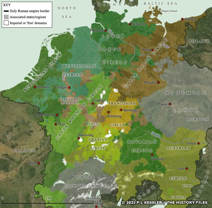
Map of German states AD 1560 |
|
Introduced in 1560, the system of imperial states replaced the now-outdated feudal system. An imperial circle ('Reichskreis') was a regional grouping of the imperial states. Although arranged as a means of organising a common defence policy and imperial tax collection, the circles were also used as a means of organisation in the imperial diet. All circles had a regional diet (a 'Kreistag') of which all territories in the circle were participants, although not all states in the circles had a seat in the imperial diet. A clickable version of this map is available for desktop displays. To select a state or territory for further information, click on its name or anywhere within its borders.
Map navigation: |
|
Original text and map copyright © P L Kessler and the History Files. An original feature for the History Files. Go back or return home. |