|
|


|
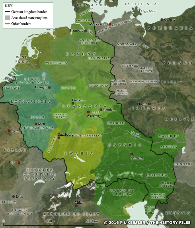
Map of German states AD 962 |
|
Germany in the tenth century may have had its emperor to govern the territories shown within the dark black line, but it was still a patchwork of competing interests and power bases, most notably in the five great stem duchies. Many of those were constantly attempting to expand their own territories outside the empire, a process which created various 'march' or border regions to the east and south of the imperial territories. A clickable version of this map is available for desktop displays. To select a state or territory for further information, click on its name or anywhere within its borders.
Map navigation: |
|
Original text and map copyright © P L Kessler and the History Files. An original feature for the History Files. Go back or return home. |