|
|
|
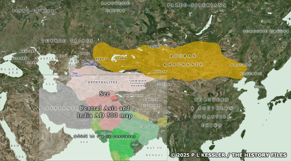
Map of Central Asia AD 490-500 |
|
A prelude to later Central Asian states which would be created by horse-borne warriors on the sweeping steppelands, the Rouran khaganate swiftly incorporated a great area of northern East Asia and Central Asia. It emerged from poorly-documented tribal beginnings under Tuoba control and with a heritage which linked it to Xianbei and earlier Donghu groups. The Rouran were able to establish their khanate in the northern desert in the fifth century AD following a degree of fresh independence after the bulk of the Tuoba migrated southwards. From the end of the fourth century AD to the middle of the sixth, the Rouran succeeded the Xiongnu and Xianbei as a powerful force on the Mongolian plateau. Along with the Turkic Chi-Le they were active across the vast plain of north-western China, a time which coincided with the 'Sixteen Kingdoms' and 'Northern and Southern Dynasties' periods of Chinese history. To the south the Rouran were buffered by the fractured Chinese imperial states, primarily under Northern Wei control where this connected with the khanate, and the Hephthalites who remained vassals until they were able to break away around AD 500. To the north was the uninviting tundra of Siberia. A clickable version of this map is available for desktop displays. To select a state or group for further information, click on its name.
Map navigation: |
|
Original text and map copyright © P L Kessler and the History Files. An original feature for the History Files. Go back or return home. |