|
|


|
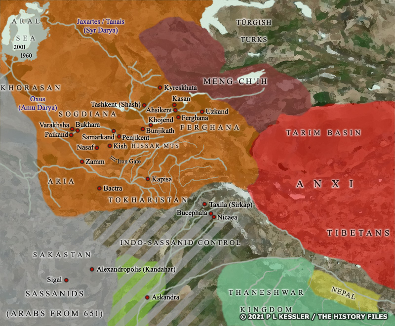
Map of Central Asia AD 600-700 |
|
By the beginning of the seventh century AD, Göktürk power in southern Central Asia was waning, primarily because the khaganate itself had been subjugated by the Tang Chinese. The Sassanids had established a degree of control over the southernmost parts of this region, along with much of South Asia outside India itself, although details are largely obscure. In Sogdiana, divided from Tokharistan by the Iron Gate, and neighbouring Ferghana a patchwork of city states emerged in the late sixth century. This strengthened during the seventh century, with them initially seeming to be interconnected (although poor records may hide levels of discord). As the seventh century went on, though, they became more fractured, fighting one another for superiority and also fighting the sudden appearance of the Umayyad caliphate from the west. The caliphate itself, while trying piecemeal at first to conquer or subjugate, came into conflict with Tang China, which was enjoying one of the country's brief periods of external expansion. The various Chinese protectorates were establish to provide a protective buffer, with that of Anxi perhaps being the biggest and longest-established. The protectorate of Meng-Ch'ih ate into former Göktürk territory, while the Türgish Turks formed the eventual core remnants of western Göktürk power. A clickable version of this map is available for desktop displays. To select a state or city for further information, click on its name.
Map navigation: |
|
Original text and map copyright © P L Kessler and the History Files. An original feature for the History Files. Go back or return home. |