|
|
|
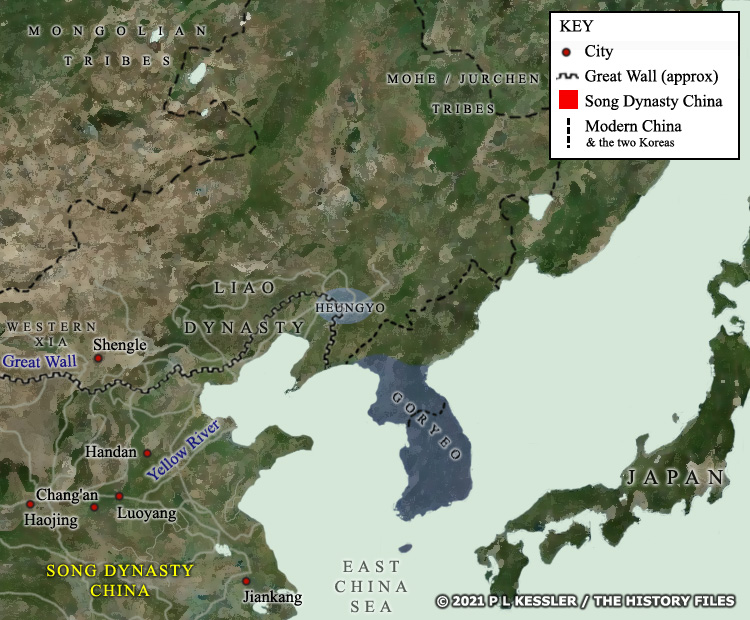
Map of East Asia AD 1029 |
|
Eleventh century Korea in the south and centre of the peninsula was united under the single rule of Goryeo. This state had taken Silla and Hubaekje in the tenth century before expanding northwards and swelling its population with several waves of refugees from the Korean-Mohe kingdom of Barhae (Balhae) in the north. The Liao dynasty of Khitans who had so swiftly destroyed Barhae in 926 had not persisted as the dominant force in northern China or across Inner Mongolia and Manchuria. The Western Xia now held the westernmost parts of their territory while the Song were shored up behind the Great Wall, defending a smaller and more insular China following the 'Five Dynasties' civil war period. Now, in 1029, an attempt was made to restore at least part of the lost kingdom of Barhae when a relative of its kings pronounced the state of Heungyo on the western edges of former Barhae lands, and still within Liao-dominated regions. Betrayed from within it fell in 1030, almost the last of the restoration states of the Korean north (Daebalhae in 1116 seems to be undocumented in English). A clickable version of this map is available for desktop displays. To select a kingdom, state, or tribe for further information, click on its name.
Map navigation: |
|
Original text and map copyright © P L Kessler and the History Files. An original feature for the History Files. Go back or return home. |