|
|
|
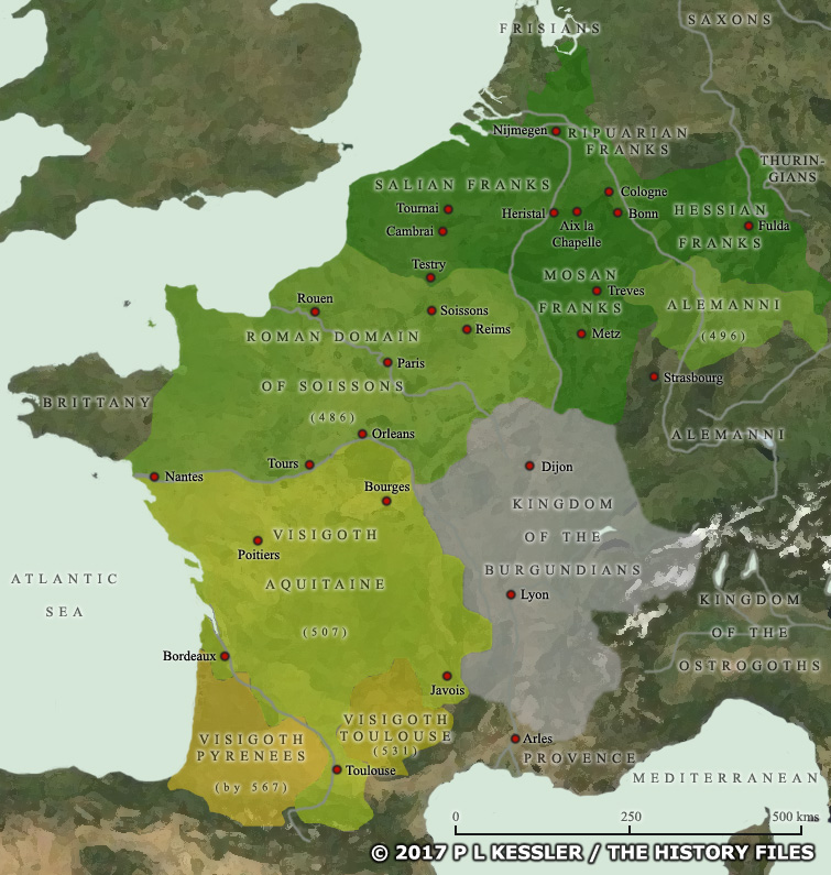
Map of Western Europe AD 481-511 |
|
With the accession of Clovis, son of Childeric I of the Salian Franks, the Germanic occupiers of north-eastern Gaul had found a king who would change their fortunes out of all recognition. Rather than follow his father's policy of allying himself with the Roman domain of Soissons and trying to preserve some kind of peace in Gaul, Clovis pursued a highly aggressive policy of expansion. He united the two main branches of the Franks, the Salians on the west bank of the Rhine and the Ripuarian Franks on the east bank, and converted them all to Christianity in AD 497. Between then and 509 he also took steps to eliminate his rival Frankish kings, killing them and annexing their territory. Soissons was taken in 486, opening up western and central Gaul and allowing Clovis to move the Frankish capital to the small town of Paris. The Alemanni were beaten in 496. In 507 the Visigoth kingdom of Toulouse was defeated and the Visigoths forced to retreat into Spain. The Auvergne was secured, but Aquitaine remained disputed for quite some time. A rare defeat came in 510, when an Ostrogoth success at Narbonne forced Clovis away from the Mediterranean coast. A clickable version of this map is available for desktop displays. To select a state or territory for further information, click on its name or anywhere within its borders.
Map navigation: |
|
Original text and map copyright © P L Kessler and the History Files. An original feature for the History Files. Go back or return home. |