|
|


|
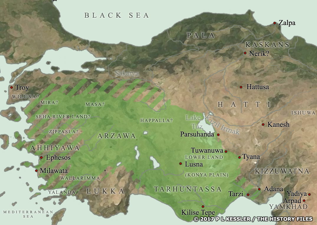
Map of Anatolia c.1450 BC |
|
The state of Arzawa existed from at least 1650 BC. By around 1450 BC it controlled the solid green section of the map, which included the state of Tarhuntassa, but probably not the 'Lower Land' (hatched areas are debatable). Within about twenty years, Madduwattas, from his mountain kingdom of Zippasla and with Hittite help, conquered Arzawa for himself and as a Hittite ally. Even so, the kingdom seems to have retained its independence for another century before apparently fragmenting into a series of sub-kingdoms. The sub-kingdoms of Mira, Masa, the Seha River Land, and Happalla formed a collection of 'northern border states'. During the 1300s these came to the fore as bickering brothers attempted to usurp each other. Their precise locations are uncertain, with the possibility that Mira and Seha River Land should swap position. By the 1330s the kingdom had been reunited under a fresh leader and, just as unity promised a stronger state, the entire territory was conquered by the Hittites who themselves were enjoying a period of resurgence. Main sources A clickable version of this map is available for desktop displays. To select a state for further information, click on its name.
Map navigation: |
|
Original text and map copyright © P L Kessler
and the History Files. An original feature for the History Files. |