|
|
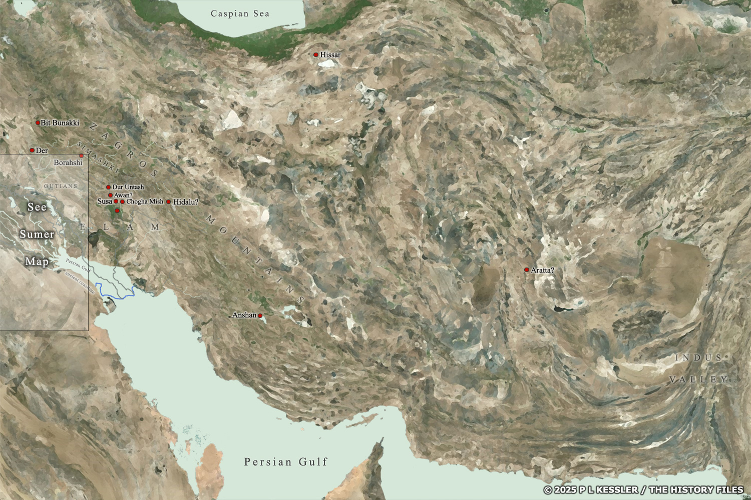 |
Map of Elam and the Iranian plateau c.3000-1500 BC |
|
|
Although extensive city-building emerged in Sumer in the late fourth millennium BC and continued throughout the third, the same process was slower to get started in northern Mesopotamia and in Elam. In fact the entire Iranian plateau stretching over to the Indus Valley civilisation in today's Pakistan only engaged fully with city-building from the very end of the fourth millennium BC and then more enthusiastically in the third. Cities such as Susa and Chogha Mish on the plain to the immediate east of Sumer benefited the most, but cities with more eastwards locations also swiftly caught up, enjoying the benefits of a network of trading routes which stretched east to the Indus and north to reach the Hissar culture and the BMAC in Bactria and Margiana. Overfarming and poor handling of resources in Sumer during the Gutian period of domination in the last quarter of the third millennium BC meant a slow decline and collapse there, followed by a short dark age of a century or so. The focus in Mesopotamia switched to the central regions and the north, but in Elam the chance was grasped to create a unified kingdom which was free for a time from Mesopotamian interference. Instead Elam attempted to extend its own domination over areas of southern Mesopotamia. Scroll the map left and right to view it in its entirety. To select a city, grouping, or state for further information, click on its name or within its borders.
Map navigation: |
|
|
Original text and map copyright © P L Kessler
and the History Files. An original feature for the History Files. |
|