|
|
|
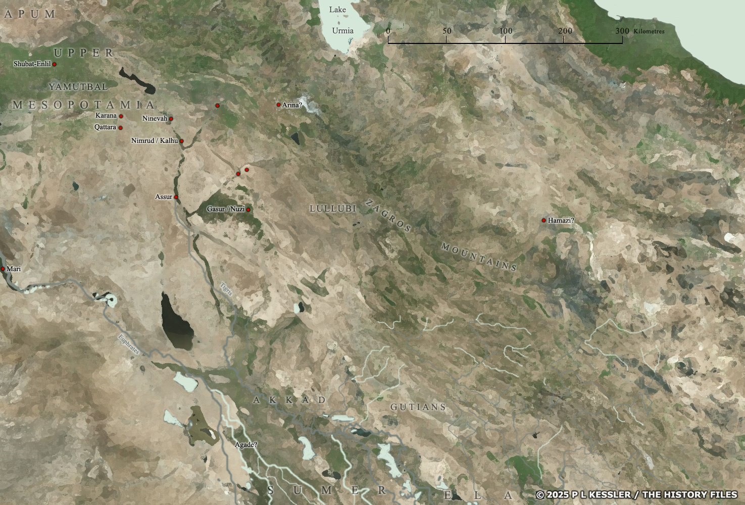
General map of Northern Mesopotamia |
|
While extensive city-building emerged in southern Mesopotamia - specifically Sumer - in the late fourth millennium BC and throughout the third, the same process was slower to get started in northern Mesopotamia. Today those areas form northern Iraq, the north-western corner of Iran, the south-eastern edge of Turkey, and the eastern part of Syria. It was only towards the end of the third millennium BC that larger cities truly became established in the north, and even then the process took place in a region which still contained a maze of minor cities and larger towns. The arrival of Amorite groups in the later third millennium BC seems to have been the spark here to start a race towards urban supremacy, while older cities such as Assur and Nineveh were also nudged into life and grew quickly. The creation of the short-lived kingdom of 'Upper Mesopotamia' at the end of the nineteenth century BC gave the region a fresh drive to create cities states and larger territories. To an extent the old order was restored following the end of 'Upper Mesopotamia' but the subsequent jostling for dominance could be fierce and bloody. At the same time, overfarming and poor handling of resources in the south during the Gutian period of domination meant a slow decline and collapse there, followed by a short dark age of a century or so. The focus for a while was certainly on central Mesopotamia and the north. Main sources A clickable version of this map is available for desktop displays. To select a state for further information, click on its name.
Map navigation: |
|
Original text and map copyright © P L Kessler
and the History Files. An original feature for the History Files. |